GIS & Cartography
Remote Sensing
art
Research
About
GIS & Cartography
Remote Sensing
art
Research
About
Otter Creek
A map of the otter creek wetlands, created for a cartographic design course in the spring of 2019.
You may also like
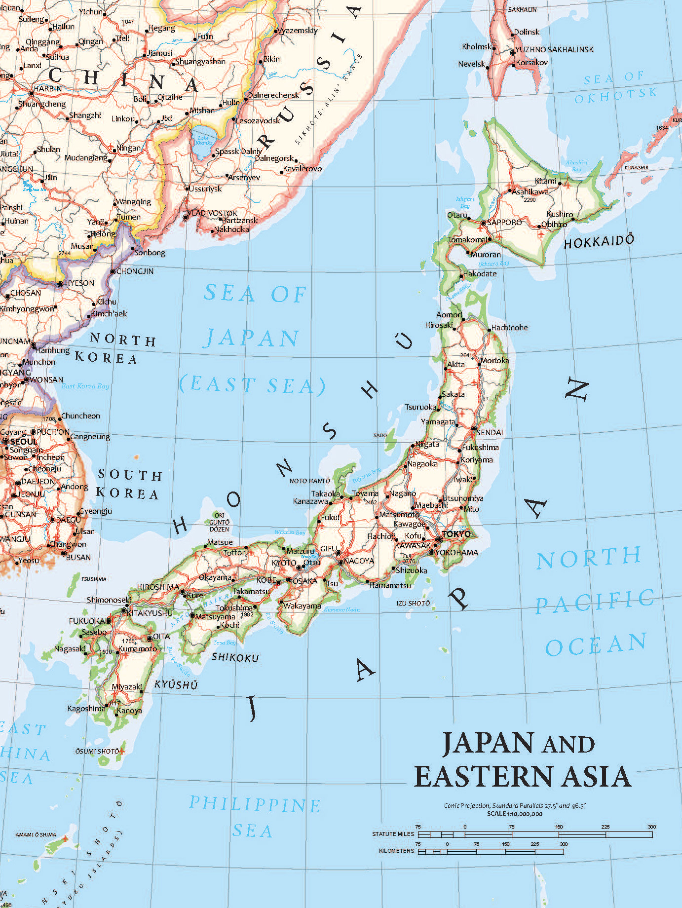
Japan Reference Map
2020
Middlebury's Languages
2020
Mongolia
2020
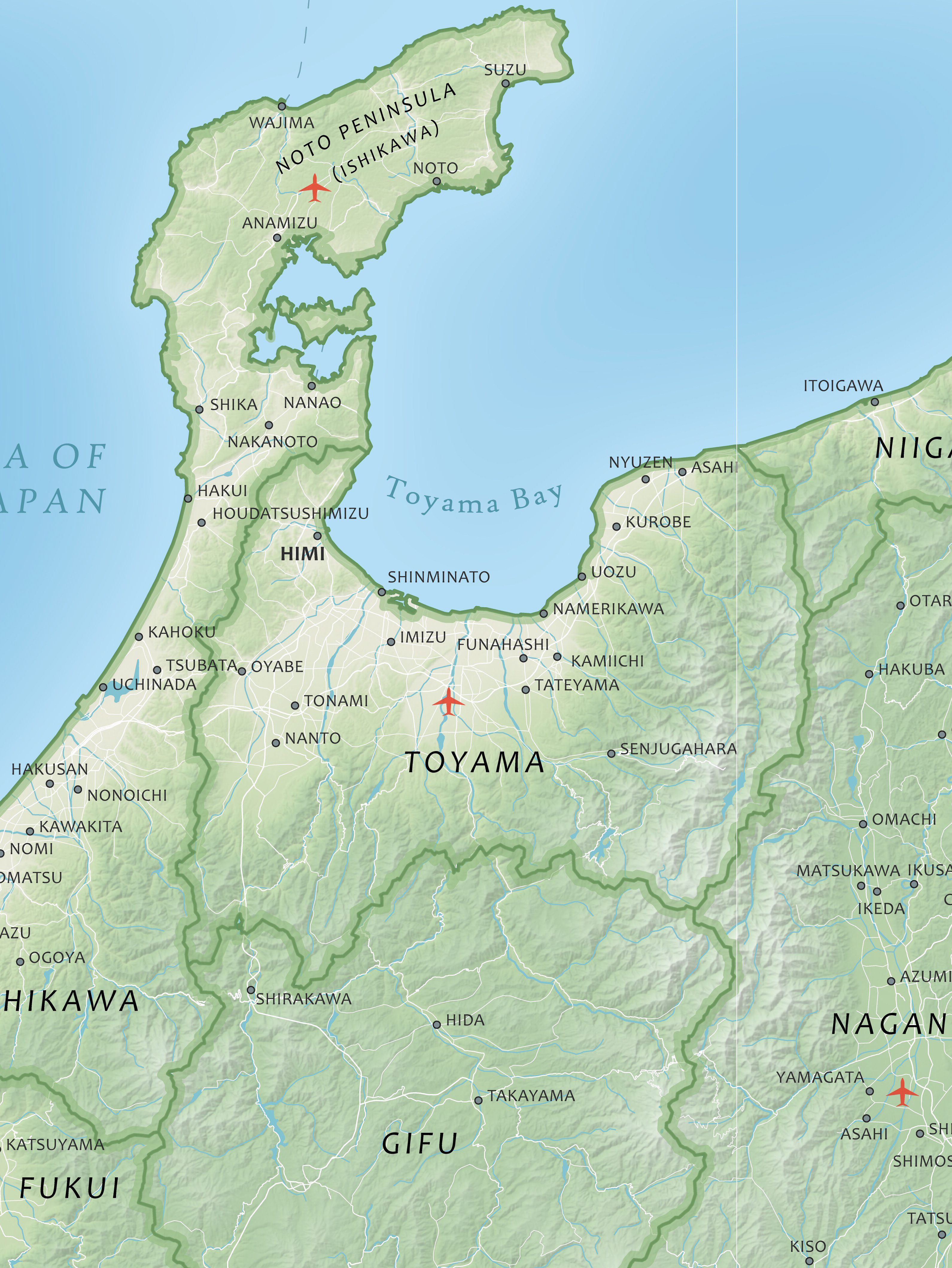
Japan
2020
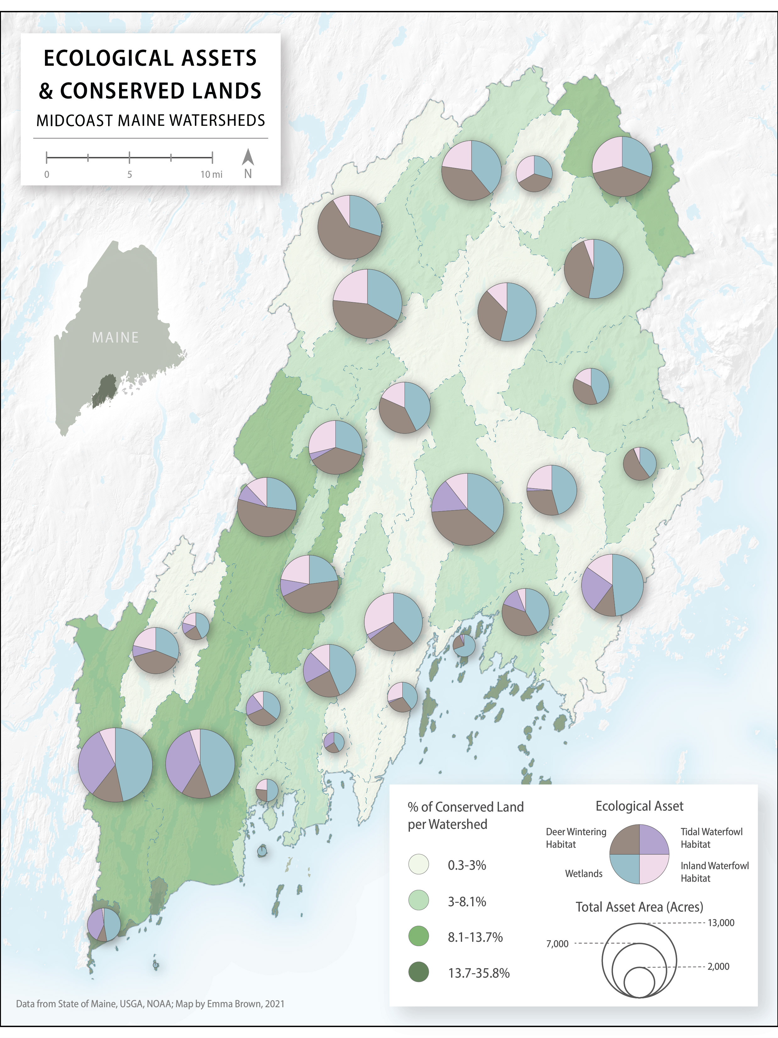
Watershed Conservation, Mid-Coast Maine
2021
Sap Map
2020
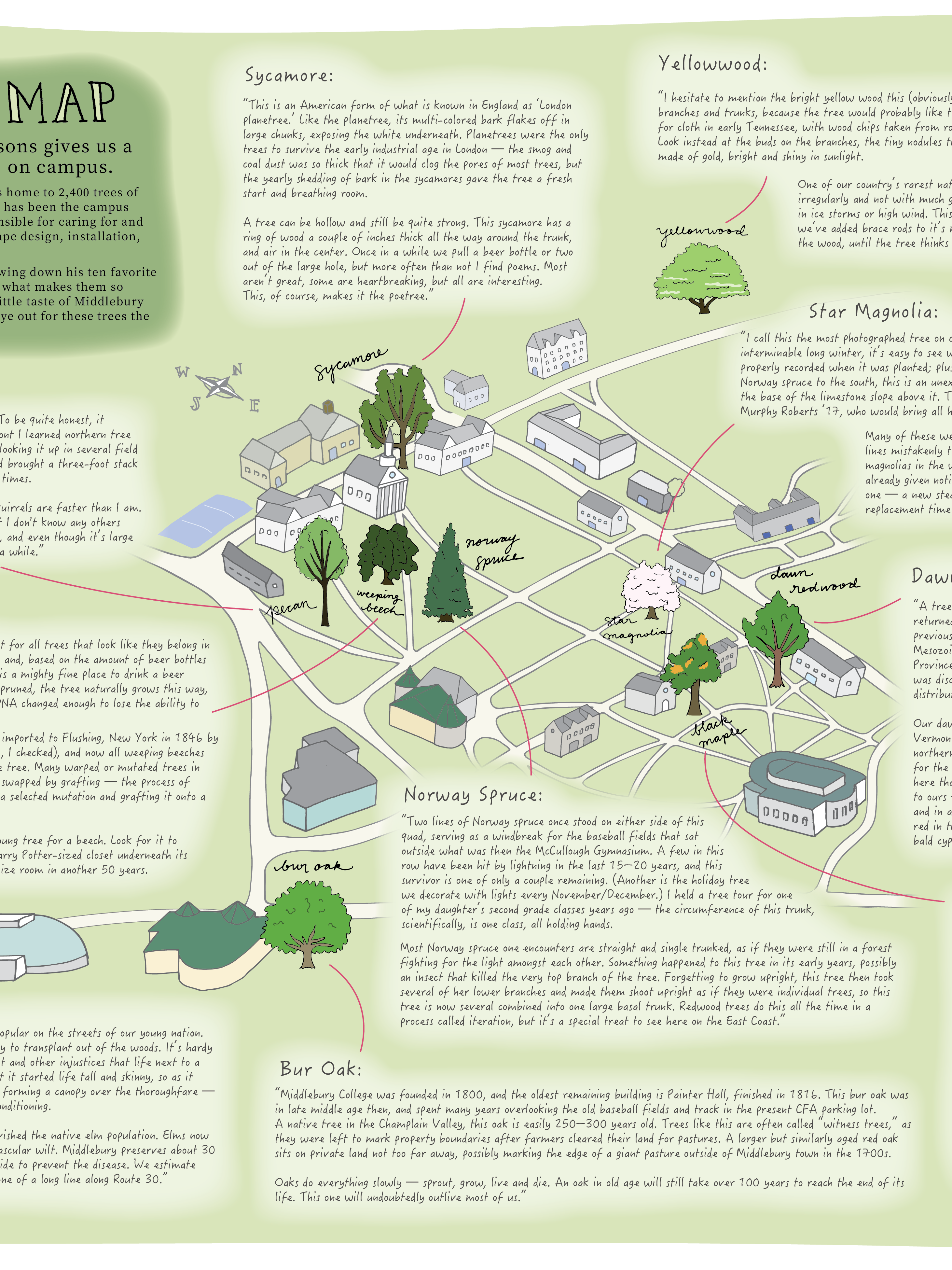
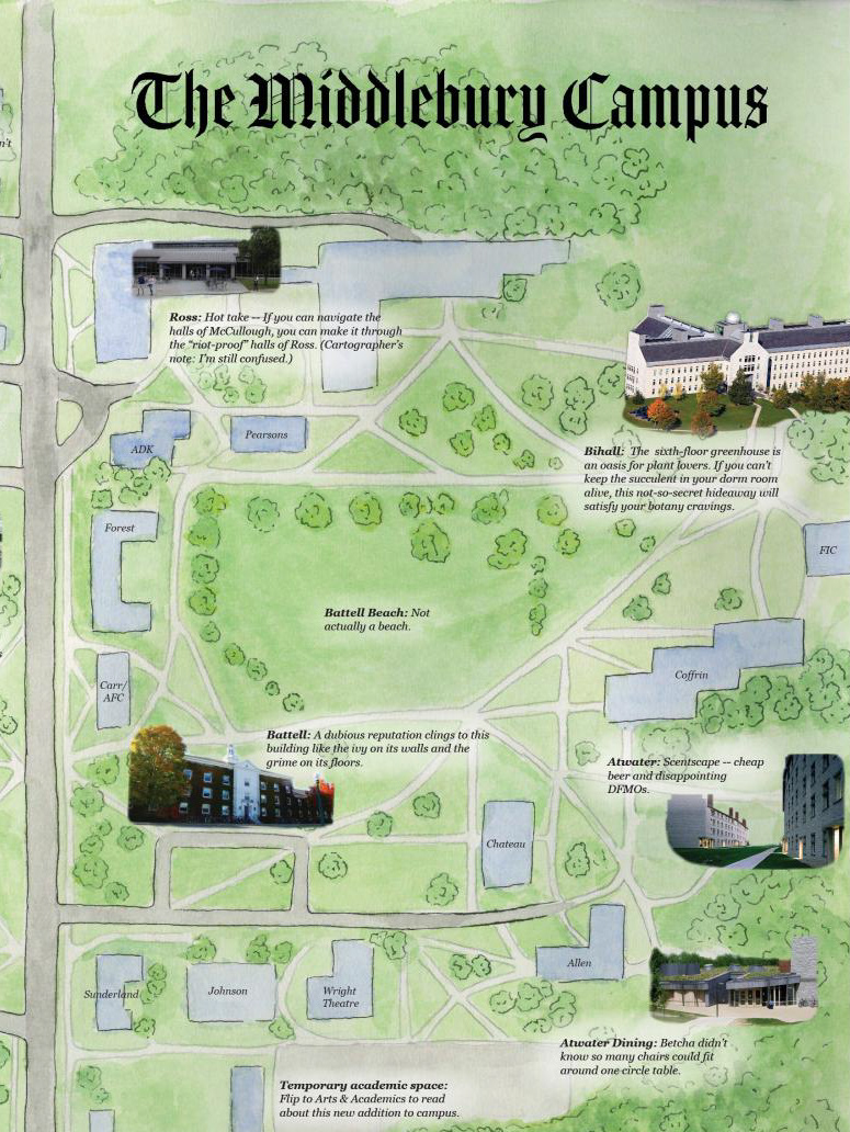
Middlebury Campus Map
2020
Old Timey Middlebury
2020
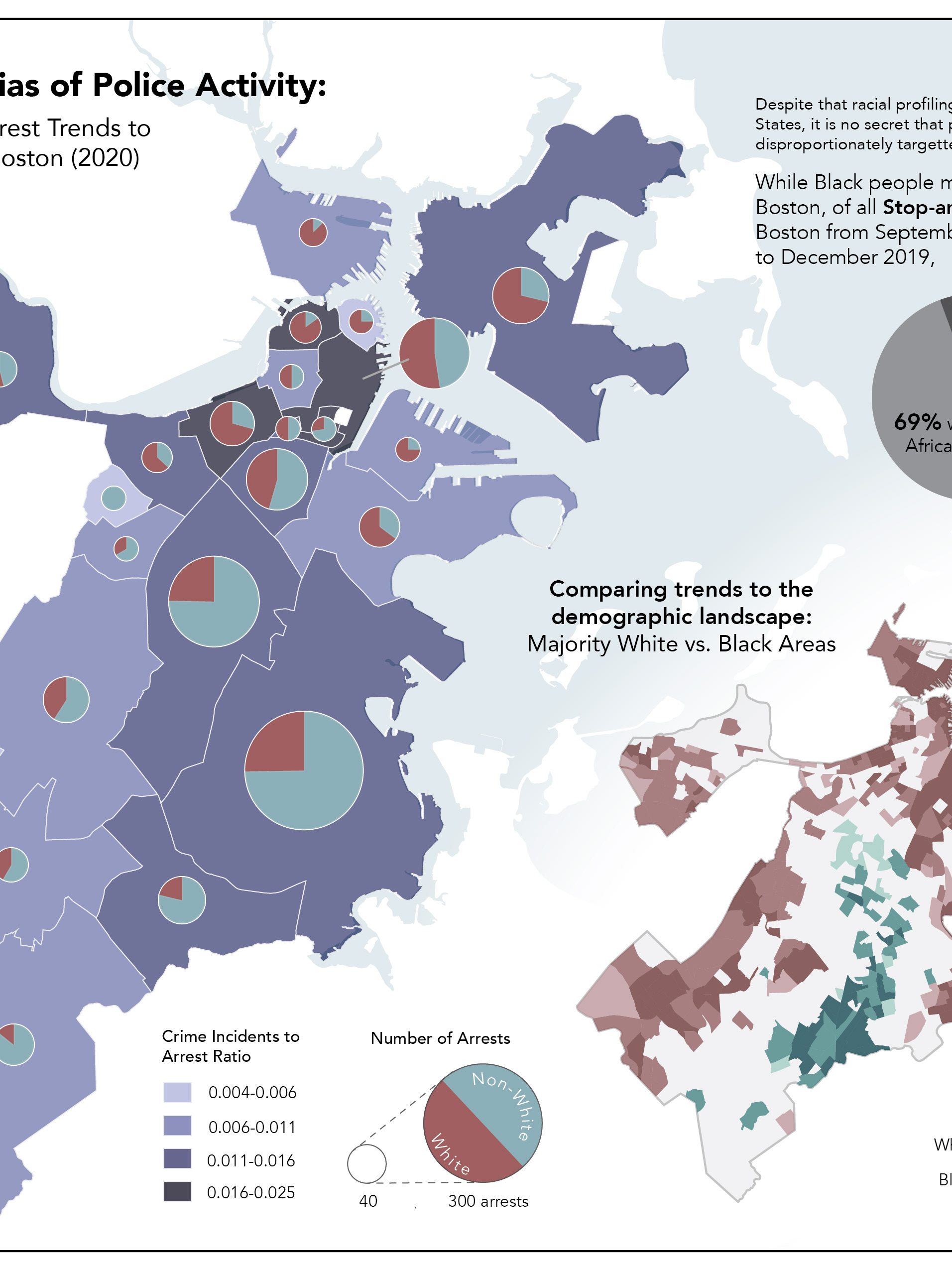
Exploring Racial Bias in Police Activity, Boston
2021
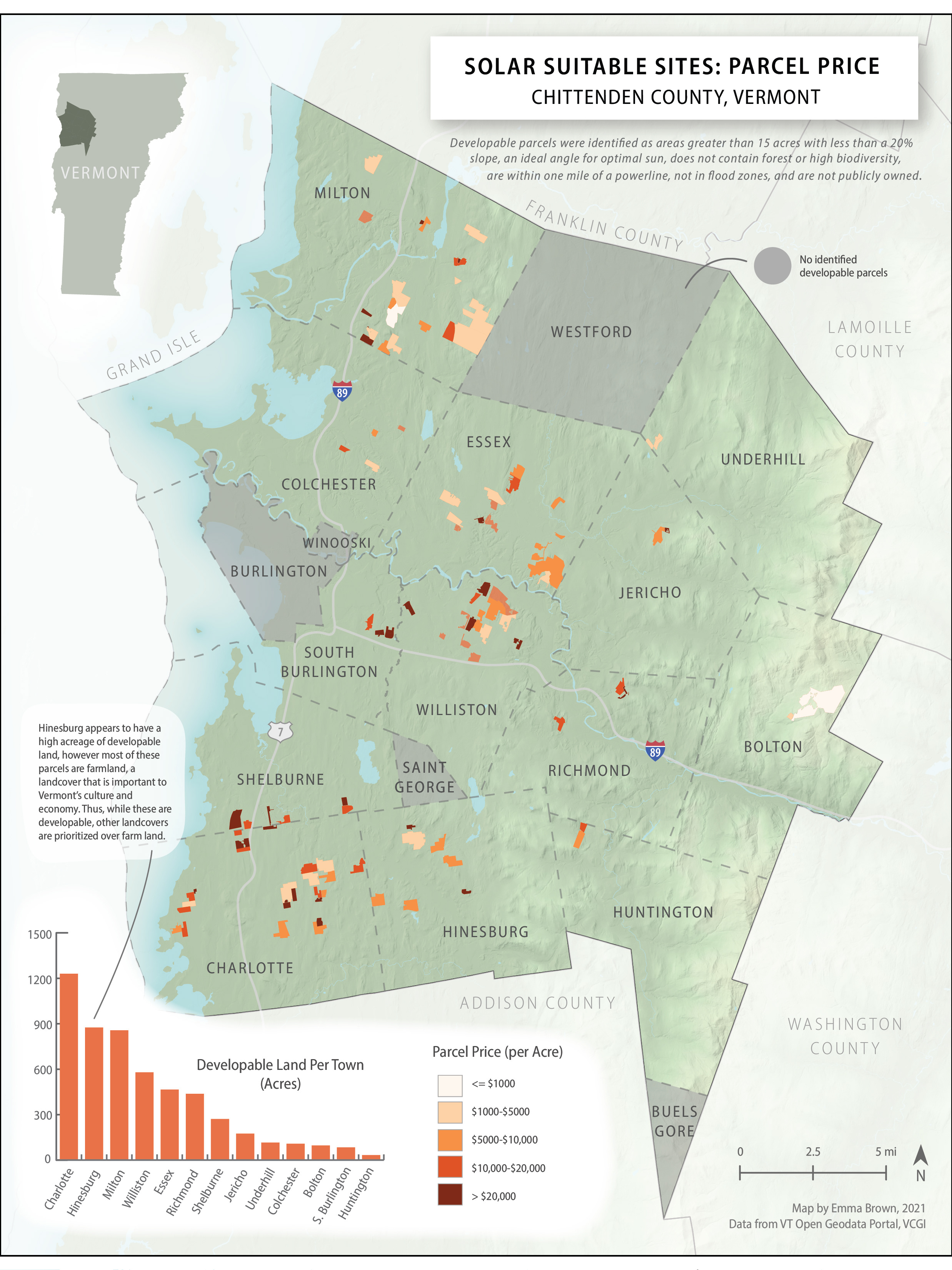
Solar Power Suitability in Chittenden County, VT
2021
↑
Back to Top